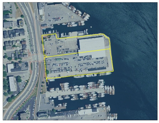
The New Bedford State Pier is located to the west of the Acushnet River on MacArthur Drive in New Bedford, MA. The site contains approximately 8 acres (3.2 hectares) of land, and is currently being used as the New Bedford Ferry Terminal, warehousing for cargo operations, and berths for large vessels calling on the Port of New Bedford. The pier is owned by the Commonwealth of Massachusetts, with certain activities currently overseen by the New Bedford Harbor Development Commission.
The site has good access to the interstate highway, to deep water, and a local workforce. The site is 35 nautical miles (65 km) from the leading edge of the offshore wind energy areas located south of Martha’s Vineyard, with no overhead restrictions. The site has a navigable depth restriction of -28.9 ft (8.8 m) MLLW into New Bedford Harbor and a width restriction from the New Bedford/Fairhaven Hurricane Barrier of 150 feet (45.7 m).
Download the New Bedford State Pier Redevelopment and Reuse Assessment to view the potential redevelopment and reuse options at the site, including detailed cost information. Return to the main Ports Assessment page to read the full reports and visit the Massachusetts Offshore Wind Ports & Infrastructure Maps.
And download the New Bedford State Pier Existing Conditions Report to read the comprehensive assessment of the existing site conditions at New Bedford State Pier.
As part of the existing conditions assessment, MassCEC has compiled a repository of existing documentation on the New Bedford State Pier, some of which is referred to in the Report. All site documentation is available below:
- Site photos
- Current photos
- Historical photos
- Site plans
- Environmental reports
- RTNs – Release Tracking Numbers
- Site Licenses
- NOAA Chart 13232 New Bedford Harbor and Approaches
- Other documents