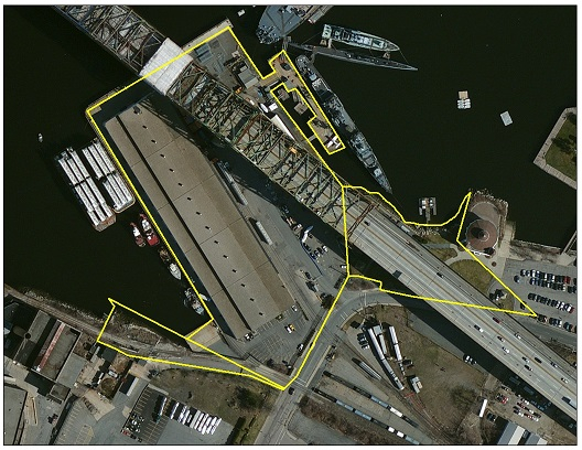
The Fall River State Pier is located along the east bank of the Taunton River at 1 Water Street in Fall River, MA. The 10-acre (4 hectare) property is one of several state piers owned by the Commonwealth of Massachusetts. It is operated by Fall River Line Pier, Inc. as a marine terminal for general cargo and breakbulk industry, as well as commercial fishing vessels, ferry service, and the cruise ship industry.
The Fall River State Pier is located approximately 0.1 miles (0.1 km) from Interstate Route I-195 and approximately 37 nautical miles (68 km) from the leading edge of the offshore wind energy areas located south of Martha’s Vineyard, although it lies partially under the Charles M. Braga Jr. Memorial Bridge. The site is accessible by two deep water berths, on-site rail, and a trucking fleet in close proximity to the interstate highway system.
Download the Fall River State Pier Redevelopment and Reuse Assessment to view the potential redevelopment and reuse options at the site, including detailed cost information. Return to the main Ports Assessment page to read the full reports and visit the Massachusetts Offshore Wind Ports & Infrastructure Maps.
And download the Fall River State Pier Existing Conditions Report to read the comprehensive assessment of the existing site conditions at Fall River State Pier.
As part of the existing conditions assessment, MassCEC has compiled a repository of existing documentation on the Fall River State Pier site, some of which is referred to in the Report. All site documentation is available below:
- Site photos
- Site plans
- Environmental reports
- RTNs – Release Tracking Numbers
- NOAA Chart 13226 Mount Hope Bay
- Other documents